Kayaking in Denver, CO: Urban Waters & Mountain Rivers Guide
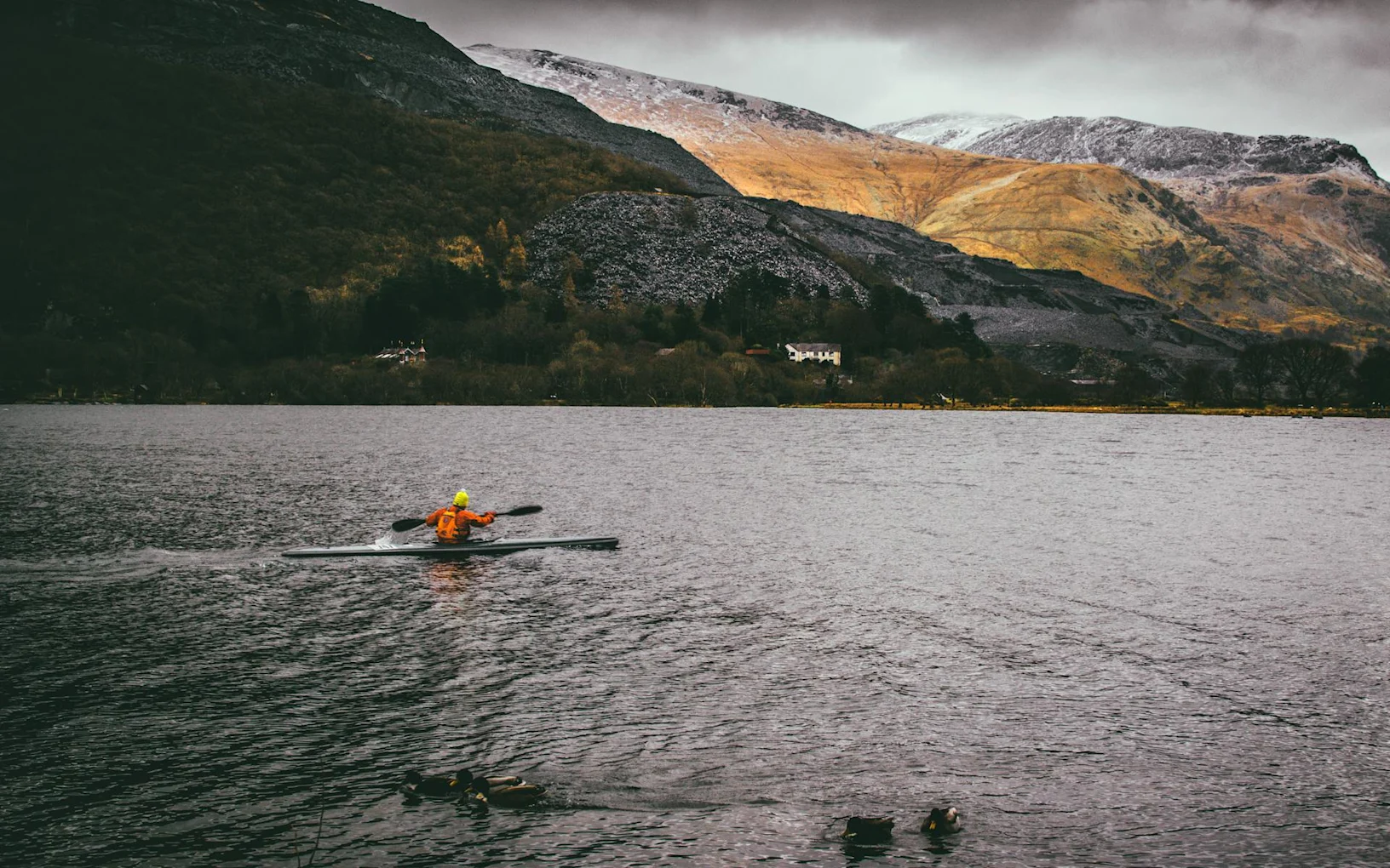
Planning your kayaking adventure in Denver, Colorado means discovering an unexpected paddling paradise where the Mile High City's urban waterways meet world-class mountain rivers within an hour's drive. Denver sits at the confluence of the South Platte River and Cherry Creek, offering in-city kayaking alongside quick access to technical whitewater in Clear Creek Canyon, mellow floats through golden plains, and high-alpine paddling in Rocky Mountain National Park.
Here's what makes Denver extraordinary for kayaking: you're positioned in a city with downtown whitewater parks, year-round paddling opportunities (thanks to 300+ days of sunshine and dam-controlled flows), progression from beginner-friendly flatwater to expert-only Class V rapids, and a vibrant kayaking community supporting paddlers at every level. Whether you're seeking morning laps at Confluence Park before work, weekend river trips through mountain canyons, or multi-day expeditions on Colorado's legendary rivers, this guide will help you navigate Denver's kayaking opportunities safely.
With access to urban whitewater parks providing free training grounds, Clear Creek offering continuous Class II-IV whitewater just 20 minutes west, the South Platte River threading through the city with multiple play features, and legendary runs like Gore Canyon and the Arkansas River within day-trip range, Denver serves as the ultimate kayaking destination. The region's diverse waterways, established paddling infrastructure, and mountain snowmelt creating reliable summer flows make this one of America's premier kayaking cities.
UNDERSTANDING DENVER KAYAKING: What You're Getting Into

Urban Kayaking vs. Mountain Rivers
Critical Distinction: Denver kayaking divides into fundamentally different experiences requiring different skills, equipment, and mindset:
Urban Kayaking (South Platte River, Cherry Creek):
Whitewater parks with manufactured features
Short runs (15 minutes to 2 hours)
Easy access from roads and parking
Consistent, dam-controlled flows
Park-and-play environment with repeated features
Rescue and egress readily available
Suitable for learning and progression
Mountain River Kayaking (Clear Creek, Arkansas, Colorado River):
Natural whitewater with continuous rapids
Long runs (1-6 hours typical)
Remote canyon settings
Snowmelt-dependent flows (highly variable)
Commitment with limited egress points
Self-rescue essential
Serious consequences for mistakes
This distinction matters enormously. Paddlers who dial in Class III features at Confluence Park often assume they're ready for Clear Creek's continuous Class III-IV whitewater. The technical difficulty is one factor—the commitment, cold water, continuous nature, and consequences create a completely different challenge.
The South Platte River: Denver's Kayaking Highway
South Platte Through Denver:
Elevation: 5,130-5,280 feet (minimal altitude impact)
Length: 10+ miles through metro area
Whitewater Parks: 7 parks with manufactured features
Season: Year-round (dam-controlled flows)
Difficulty: Class I-III depending on park
Water Temperature: Cold year-round (40-60°F typical)
Flow: 150-800 cfs typical (higher during runoff)
What Makes It Special: The South Platte represents one of North America's most successful river restoration projects, transforming from polluted industrial waterway to vibrant recreational resource. Multiple whitewater parks provide free access to features that would cost thousands to access at commercial kayaking facilities.
Urban Kayaking Statistics:
River miles: 10+ miles of continuous paddling through Denver
Whitewater parks: 7 distinct parks from Chatfield to Brighton
Average gradient: 30-50 feet per mile (moderate)
Annual paddling days: 365 (year-round access)
Typical users: 50-200 paddlers daily at popular parks (summer weekends)
Required Skills for Denver Kayaking
Minimum Competencies for Urban Whitewater Parks:
Fundamental Kayak Skills:
Confident wet exit and swimming position
Forward stroke and basic maneuvering
Ferry angles and eddy turns
Reading water (identifying features, currents, hazards)
Self-rescue (swimming to shore with boat)
Roll helpful but not essential (for Class II-III parks)
For Mountain Rivers (Clear Creek and Beyond):
Bombproof roll in moving water
Confident Class III paddling
Reading complex rapids
Boat scouting capabilities
Strong ferry and eddy technique
Self-rescue in continuous whitewater
Swimming and rope rescue skills
Cold water preparedness
Conservative decision-making
Physical Fitness:
Core strength for bracing and rolling
Shoulder stability and strength
Cardiovascular endurance for continuous paddling
Flexibility (especially hips and trunk)
Cold water tolerance
Reality Check: These aren't suggestions—they're minimums. Colorado's mountain rivers are cold (snowmelt), continuous (limited recovery pools), and remote (rescue difficult). The combination of altitude, cold water, and technical rapids creates serious hazards even on "moderate" rivers.
GETTING STARTED: Urban Whitewater Parks
Confluence Park: Denver's Premiere Training Ground

Confluence Park sits at the junction of Cherry Creek and the South Platte River, providing Denver's most popular and accessible kayaking venue just minutes from downtown.
Park Features:
Two distinct wave trains (north and south chutes)
Multiple play features (waves, holes)
Easy boat access (put-in and take-out adjacent)
Spectator viewing areas
Changing facilities and parking
Characteristics:
Access: 5 minutes from downtown Denver
Difficulty: Class II-III depending on flow
Season: Year-round
Flow: Best at 250-450 cfs
Water Temperature: 40-60°F (wetsuit/drysuit recommended)
Run Length: 200 yards (continuous laps possible)
Why Start Here: Confluence Park offers the perfect progression environment—short consequence features you can session repeatedly, easy egress if things go wrong, other paddlers around for assistance, and features that work across a wide flow range.
Recommended Approach for Beginners:
First Visit: Walk the park and watch paddlers
Second Visit: Paddle the flat water above and below features
Third Visit: Run the easier south chute at moderate flows
Progressive Sessions: Build to north chute and play features
Other Denver Metro Whitewater Parks
Downtown Park (15th Street):
Location: 15th Street and Platte Street
Features: Single drop with play wave
Difficulty: Class II-III
Best for: Intermediate paddlers, play boating
Flow: 200-500 cfs optimal
Centennial Park (Englewood):
Location: Dartmouth Avenue and Santa Fe Drive
Features: Multiple drops and waves
Difficulty: Class II+
Best for: Learning to read water, basic moves
Flow: 150-400 cfs optimal
Overland Park:
Location: South Platte and I-25
Features: Long wave train with multiple features
Difficulty: Class II-III
Best for: Surfing, attaining, continuous practice
Flow: 200-600 cfs optimal
Harvey Gap (Golden):
Location: Clear Creek at 10th Street, Golden
Features: Single ledge hole
Difficulty: Class III
Best for: Play boating, advanced moves
Flow: 400-800 cfs optimal
Note: This is Clear Creek (mountain water, colder, more powerful)
Union Chutes (Commerce City):
Location: 64th Avenue
Features: Long rapid with multiple features
Difficulty: Class II-III
Best for: Longer runs, continuous practice
Flow: 300-700 cfs optimal
Kayak Rentals and Instruction
Confluence Kayaks:
Location: Confluence Park
Rentals: Whitewater kayaks, recreational boats, SUPs
Instruction: Beginner through advanced courses
Cost: Rentals $40-60/day, instruction $150-300 per day
Golden River Sports:
Location: Golden (Clear Creek access)
Rentals: Full kayaking equipment
Instruction: Whitewater kayaking courses
Guided trips: Clear Creek, Arkansas River
Cost: Similar pricing structure
Colorado Kayak Supply:
Location: Denver (equipment shop)
Rentals: Demo boats available
Instruction: Classes and coaching
Community: Connection to local paddling groups
Benefits of Professional Instruction:
Proper technique from start (avoiding bad habits)
Safety systems and understanding
Equipment selection guidance
Progression planning
Community introduction
Higher confidence and faster learning
CLEAR CREEK: Denver's Mountain Whitewater
Understanding Clear Creek

Clear Creek flows from the Continental Divide through the mountains west of Denver, providing continuous whitewater kayaking just 20-40 minutes from the city. This is where Denver's urban kayaking meets serious mountain whitewater.
Clear Creek Overview:
Source: Continental Divide (Loveland Pass area)
Length: 50+ miles (multiple sections)
Elevation: 10,000+ feet to 5,500 feet
Difficulty: Class II-V depending on section
Season: May-August (snowmelt dependent)
Water: Cold (45-55°F even in summer)
Character: Continuous technical whitewater in narrow canyon
What Makes It Serious: Clear Creek isn't a step up from urban parks—it's a leap. The continuous nature means limited rest pools, the cold water creates immediate hypothermia risk, the canyon walls restrict egress, and the flow varies dramatically with temperature and snowmelt.
Clear Creek Sections
Lawson Section (Class II-III):
Put-in: Lawson (I-70 Exit 243)
Take-out: Downieville or Idaho Springs
Distance: 3-5 miles depending on take-out
Difficulty: Class II-III
Character: Continuous read-and-run whitewater
Best for: First-time mountain river paddlers with solid skills
Flow: 400-1,000 cfs optimal
Time: 1-2 hours
Key Characteristics:
Easier than downstream sections but still continuous
Good warm-up or introduction to creek boating
Multiple rapids requiring active boat control
Cold water and limited eddies demand solid fundamentals
Idaho Springs Section (Class III-IV):
Put-in: Idaho Springs
Take-out: Kermitts Roadhouse or Golden
Distance: 7-12 miles depending on take-out
Difficulty: Class III-IV
Character: Continuous technical whitewater with several notable rapids
Best for: Confident Class III paddlers ready for Class IV
Flow: 500-1,500 cfs optimal
Time: 2-4 hours
Notable Rapids:
Oh My God: Class IV boulder garden requiring precise lines
Charlie's Hole: Class III+ hole to avoid or surf
Numerous unnamed: Continuous Class III rapids between features
Upper Canyon (Kermitts to Golden) - Class III-IV:
Distance: 5 miles
Difficulty: Class III-IV
Character: Narrow canyon, continuous
Notable Rapid: Nomad (Class IV)
Challenges: Urban section with bridges and structures
Lower Clear Creek (Golden) - Class II-III:
Put-in: Golden (various access points)
Character: More open, easier water
Urban section: Runs through Golden
Best for: Intermediate paddlers, after-work sessions
Clear Creek Safety Considerations
Mandatory Preparation:
Reliable Roll: You WILL flip in continuous whitewater
Cold Water Gear: Wetsuit minimum (drysuit better)
Helmet: Quality helmet designed for whitewater (rocks everywhere)
PFD: Properly fitted, rescue-ready
Throw Bag: Each paddler should carry rescue rope
First Aid: Wilderness first aid training recommended
Communication: Plan with group (signals, contingencies)
Flow Considerations:
Low (200-400 cfs): Scrappy, technical, lots of rocks
Moderate (400-800 cfs): Optimal for most sections
High (800-1,500 cfs): Pushy, holes grow, consequences increase
Flood (1,500+ cfs): Expert only, life-threatening
Check Flows: USGS gauges (Idaho Springs, Golden) provide real-time data. Flow changes significantly during day as temperature affects snowmelt.
Cold Water Reality: At 50°F, cold water shock occurs immediately, swimming ability degrades rapidly, and hypothermia timeline is 30-60 minutes. This changes everything about consequence and self-rescue.
ARKANSAS RIVER: Colorado's Legendary Whitewater
The Arkansas: Day Trip from Denver
The Arkansas River, flowing through central Colorado's Rocky Mountains, ranks among North America's most popular commercial rafting rivers and offers world-class kayaking from Class II to Class V across multiple sections.

Distance from Denver: 2-2.5 hours (Buena Vista/Salida area)
Why It Matters: The Arkansas provides reliable summer flows (snowmelt from Sawatch Range), progression from beginner to expert sections, stunning mountain scenery, and developed paddling infrastructure with multiple access points.
Arkansas River Sections
Numbers Section (Class III-IV):
Location: Buena Vista to Salida
Distance: 11 miles
Difficulty: Class III-IV
Character: Continuous big water rapids
Flow: 800-3,000+ cfs (bigger is better)
Best for: Intermediate/advanced paddlers
Notable Rapids:
Pine Creek Rapid (Class IV+): Biggest rapid, multi-stage boulder garden
Numbers 1-6: Series of Class III-IV rapids
Big Drop: Class IV
Browns Canyon (Class III+):
Location: Below Numbers
Distance: 10 miles
Difficulty: Class II-III+
Character: Continuous action, stunning canyon
Flow: 800-2,000 cfs optimal
Best for: Intermediate paddlers, scenic trip
Bighorn Sheep Canyon (Class IV-V):
Location: Below Salida
Distance: 8 miles
Difficulty: Class IV-V
Character: Steep, continuous, remote
Best for: Advanced/expert only
Notable: Several Class V rapids, serious commitment
Arkansas River Considerations
Commercial Presence: Heavy commercial rafting traffic (June-August). Kayakers share river with dozens of rafts daily on popular sections.
Camping: Established BLM campgrounds along river, some requiring advance reservation
Season: May-September (peak June-July during snowmelt)
Logistics: Shuttle required for all sections (commercial shuttle services available)
SEASONAL KAYAKING IN DENVER
Spring Runoff (April-June)
Peak Season: Colorado's snowmelt creates the year's highest and most powerful flows.
Characteristics:
Flows: Highest of year (can be 2-5x summer levels)
Water Temperature: Coldest (40-50°F)
Difficulty: Everything moves up one class
Hazards: Wood debris, changing features
Best for: Experienced paddlers only
Urban Parks During Runoff:
Features become more powerful and retentive
New hazards appear at high water
Rescue more difficult
Exciting for experienced paddlers, dangerous for beginners
Mountain Rivers During Runoff:
Expert-only conditions on most runs
Extreme hazards (wood, undercuts, powerful hydraulics)
Cold water substantially increases consequences
Weather unpredictable (snow possible)
Summer Paddling (June-August)
Prime Season: Most reliable and accessible kayaking.
Characteristics:
Flows: Moderate and relatively stable
Water Temperature: Warming but still cold (50-65°F)
Difficulty: Standard conditions
Weather: Afternoon thunderstorms common
Best for: All skill levels
Urban Parks: Ideal conditions at moderate flows (300-500 cfs South Platte)
Mountain Rivers: Accessible and at optimal levels (mid-June through July typically)
Fall Kayaking (September-October)
Shoulder Season: Lower flows, fewer crowds, beautiful conditions.
Characteristics:
Flows: Lower and declining
Water Temperature: Cooling (45-55°F)
Weather: Stable but colder
Crowds: Substantially fewer
Scenery: Aspen colors in mountains
Urban Parks: Still operational but lower flows
Mountain Rivers: Technical at low water, some sections unrunnable
Winter Kayaking (November-March)
Year-Round Urban Access: South Platte urban parks remain kayakable year-round thanks to dam-controlled flows and Denver's sunny weather.
Winter Characteristics:
Flows: Low and stable (150-300 cfs typical)
Water Temperature: Very cold (35-45°F)
Air Temperature: Variable (20-60°F)
Ice: Minimal on moving water
Hazards: Hypothermia risk very high
Required Equipment:
Drysuit: Mandatory for winter paddling
Layering: Proper insulation under drysuit
Pogies/Gloves: Hand protection essential
Warm Vehicle: Immediate warming available
Mountain Rivers: Generally frozen or too low (exceptions exist with warm spells)
ESSENTIAL KAYAKING EQUIPMENT
The Kayak
Whitewater Kayak Types:
Playboats:
Length: 5'6"-6'6"
Volume: Low (under 60 liters typical)
Use: Surfing, tricks, park-and-play
Best for: Urban whitewater parks, play features
Limitations: Difficult in pushy water, not ideal for rivers
Creek Boats:
Length: 7'-9'
Volume: Medium to high (65-90 liters)
Use: River running, larger water
Best for: Clear Creek, Arkansas, river trips
Advantages: Stability, forgiveness, storage
All-Around/Intermediate Boats:
Length: 6'6"-7'6"
Volume: Medium (60-75 liters)
Use: Versatile—parks and rivers
Best for: Progression, learning
Advantages: Compromise between play and river
Sizing: Volume based on paddler weight and skill level. Beginners need higher volume for stability.
Personal Protective Equipment
PFD (Personal Flotation Device):
Whitewater-specific (higher flotation, 15+ lbs)
Proper fit (snug but not restrictive)
Rescue features (harness, knife attachment points)
Quick-release harness or not (skill-dependent)
Helmet:
Full-cut or half-cut whitewater design
Proper fit (doesn't move when shaking head)
Ear coverage recommended
No climbing or bike helmets (different impact protection)
Spray Skirt:
Neoprene for whitewater (more secure than nylon)
Properly sized for boat cockpit
Grab loop easily accessible
Must release with firm pull
Clothing and Thermal Protection
Warm Weather (June-August):
Base: Swimsuit or synthetic shorts
Top: Rash guard or synthetic shirt
Sun Protection: Long sleeves recommended (UV intense at altitude)
Wetsuit: 3mm shorty or farmer john for cold water
Footwear: Neoprene booties or water shoes (no flip-flops)
Cold Weather (September-May):
Drysuit: Essential for winter, highly recommended spring/fall
Layering Under Drysuit: Synthetic or merino base layers
Insulation: Fleece or light puffy (depending on temperature)
Footwear: Drysuit socks with neoprene booties
Hands: Pogies (neoprene hand covers) or paddling gloves
Head: Fleece beanie under helmet
Critical Note: Cotton kills in cold water. All clothing must be synthetic or merino wool.
Safety Equipment
Personal Safety Gear:
Whistle: Attached to PFD
Knife: River knife or EMT shears
Throw Bag: 50-70 feet of rescue rope (each paddler in group)
First Aid Kit: Waterproof, wilderness-appropriate
Lighter/Fire Starter: Waterproof container
Emergency Bivy: For unexpected situations
Group Equipment:
Multiple Throw Bags: At least one per 2-3 paddlers
First Aid Kit: Comprehensive group kit
Repair Kit: Duct tape, cord, spare parts
Communication: Cell phone in drybag (limited coverage many places)
Shuttle: Vehicle at take-out or shuttle service
PERMITS AND REGULATIONS
Colorado Water Law
Navigation Law: Colorado recognizes public right to navigate waterways, but access must be from public land.
Practical Reality:
Put-ins and take-outs must be public land
Cannot cross private property to access river
Many rivers have limited legal access
Denver Metro Kayaking
South Platte River:
No permit required for day use
Public access at whitewater parks
Park in designated areas
Free access
Clear Creek:
No permit required
Multiple public access points
Some sections flow through private property (stay in water)
Parking can be limited at popular spots
Arkansas River
BLM-Managed Sections:
No permit required for private boaters
Some camping areas require permits
Commercial outfitters need permits (not relevant for private paddlers)
Browns Canyon National Monument:
No permit currently required for kayaking
May require permit in future (check current regulations)
Camping requires BLM permit
Safety Regulations
Required Equipment (Colorado):
PFD for each person
Whistle or sound-producing device
Children under 13 must wear PFD at all times
Recommendations:
Register trip plans with someone
Check flow conditions
Know your limits
Paddle with others
GUIDED TRIPS AND INSTRUCTION

Professional Guide Services
Dvorak Expeditions:
Multi-day kayaking trips
Arkansas River, Colorado River
Instruction included
All equipment provided
Cost: $500-1,500+ depending on length
Colorado Kayak Supply:
Local instruction and coaching
Urban parks and Clear Creek
Skills courses (beginner through advanced)
Rolling clinics
Cost: $150-300 per day
AVA Rafting & Zipline:
Kayak instruction on Arkansas River
Equipment rentals
Guided trips
Cost: $100-250 per day
Four Corners Riversports:
Clear Creek trips
Skills instruction
Equipment demos
Cost: $150-400 depending on program
When Guiding Makes Sense
First-Time Mountain Rivers:
Transition from urban to wilderness
Understanding flows and conditions
Learning rescue and safety
Equipment selection
Skill Development:
Breaking through plateaus
Video analysis and coaching
Technique refinement
Confidence building
Unfamiliar Rivers:
Local knowledge of hazards
Beta on specific rapids
Shuttle logistics
Safety net
CONCLUSION: Denver's Kayaking Culture

Denver, Colorado, offers a rare combination of urban accessibility and mountain wilderness, creating one of North America's premier kayaking destinations where you can surf waves downtown before breakfast and paddle world-class whitewater in the mountains by afternoon. The South Platte River's transformation from industrial channel to recreational resource demonstrates what happens when a city embraces its waterways, while Clear Creek and the Arkansas River provide the technical whitewater that makes Colorado legendary.
Whether you're taking your first strokes at Confluence Park, dialing in your roll through repetition at Overland Park, pushing into mountain rivers on Clear Creek, or making the pilgrimage to the Numbers section of the Arkansas, Denver's kayaking opportunities offer genuine progression from absolute beginner to expert paddler. The city's 300 days of sunshine, reliable summer flows from mountain snowmelt, and vibrant paddling community create ideal conditions for developing skills and experiencing the transformative power of whitewater kayaking.
The mountains are always there, the water keeps flowing, and the rivers offer endless opportunities for those willing to put in the time to learn properly and respect the genuine hazards that make kayaking both challenging and extraordinary.